
Thank you for supporting this site ❤️
Make a donation
Make a donation
Gear up for your next adventure:
As an Amazon Associate, this site earns from qualifying purchases at no extra cost to you.
Veitshöchheim topographic map
Click on the map to display elevation.
Thank you for supporting this site ❤️
Make a donation
Make a donation
Gear up for your next adventure:
As an Amazon Associate, this site earns from qualifying purchases at no extra cost to you.
About this map
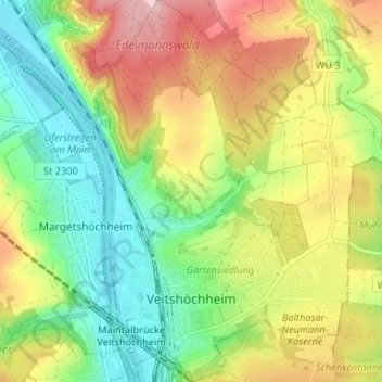
Name: Veitshöchheim topographic map, elevation, terrain.
Location: Veitshöchheim, Landkreis Würzburg, Bavaria, 97209, Germany (49.82018 9.86508 49.86265 9.92090)
Average elevation: 810 ft
Minimum elevation: 535 ft
Maximum elevation: 1,181 ft
Thank you for supporting this site ❤️
Make a donation
Make a donation
Gear up for your next adventure:
As an Amazon Associate, this site earns from qualifying purchases at no extra cost to you.