Geolocate

Sariska topographic map

Click on the map to display elevation.

About this map

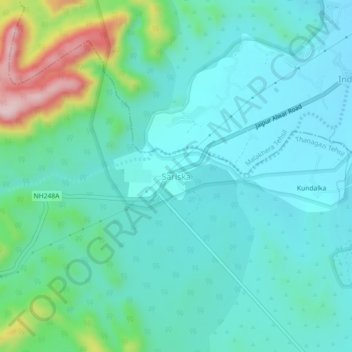
Name: Sariska topographic map, elevation, terrain.

Location: Sariska, Thanagazi Tehsil, Alwar District, Rajasthan, India (27.37273 76.35632 27.41273 76.39632)

Average elevation: 1,312 ft

Minimum elevation: 1,112 ft

Maximum elevation: 2,090 ft

Gear up for your next adventure:

🛰️Satellite Messengers - Emergency SOS and two-way messaging for off-grid adventures
💧Water Purification System - Clean water on the trail with reliable purifiers
🔭Compact Binoculars - HD vision for scouting terrain and identifying distant landmarks
🎁Geography Themed Gifts - Unique gift ideas for map lovers and geography enthusiasts
🔌USB Car Charger - Car charger for on‑the‑go power needs

As an Amazon Associate, this site earns from qualifying purchases at no extra cost to you.