Geolocate

Kom topographic map

Click on the map to display elevation.

About this map

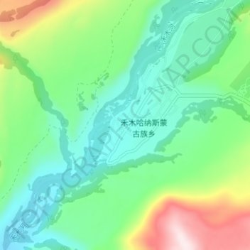
Name: Kom topographic map, elevation, terrain.

Location: Kom, Kom-Kanas Mongolian Ethnic Township, Burqin County, Altay Prefecture, Xinjiang, China (48.54921 87.41037 48.58921 87.45037)

Average elevation: 3,927 ft

Minimum elevation: 3,468 ft

Maximum elevation: 5,089 ft

Other topographic maps

Click on a map to view its topography, its elevation and its terrain.

Gear up for your next adventure:

📖Nature Tracking Books - Learn to track wildlife and terrain
🪶Fire Starter Kit - Reliable fire starter for survival and camping
🛶Inflatable Kayak - Portable kayak for rivers, lakes, and expeditions
📷Action Cameras - Rugged cameras to document your journeys across rugged terrain
🧣Merino Neck Gaiters - Multi-functional headwear for wind and sun protection

As an Amazon Associate, this site earns from qualifying purchases at no extra cost to you.