
Thank you for supporting this site ❤️
Make a donation
Make a donation
Gear up for your next adventure:
As an Amazon Associate, this site earns from qualifying purchases at no extra cost to you.
Quintela topographic map
Click on the map to display elevation.
Thank you for supporting this site ❤️
Make a donation
Make a donation
Gear up for your next adventure:
As an Amazon Associate, this site earns from qualifying purchases at no extra cost to you.
About this map
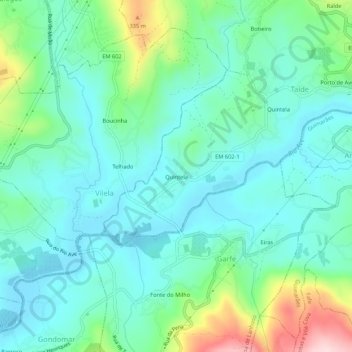
Name: Quintela topographic map, elevation, terrain.
Location: Quintela, Taíde, Póvoa de Lanhoso, Braga, 4830-291, Portugal (41.52789 -8.26848 41.56789 -8.22848)
Average elevation: 620 ft
Minimum elevation: 407 ft
Maximum elevation: 1,316 ft
Thank you for supporting this site ❤️
Make a donation
Make a donation
Gear up for your next adventure:
As an Amazon Associate, this site earns from qualifying purchases at no extra cost to you.