Geolocate

Lakhani topographic map

Interactive map

Click on the map to display elevation.

About this map

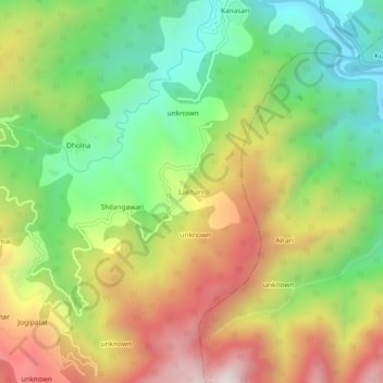
Name: Lakhani topographic map, elevation, terrain.

Location: Lakhani, Garud, Bageshwar District, Uttarakhand, 263641, India (29.84914 79.63464 29.88914 79.67464)

Average elevation: 4,718 ft

Minimum elevation: 3,409 ft

Maximum elevation: 6,391 ft

Other topographic maps

Click on a map to view its topography, its elevation and its terrain.

Garur

India > Uttarakhand > Garud

Garur, Garud, Bageshwar District, Uttarakhand, 263641, India

Average elevation: 4,035 ft

Nakuri

India > Uttarakhand > Garud

Nakuri, Garud, Bageshwar, Uttarakhand, 263639, India

Average elevation: 5,351 ft