
Thank you for supporting this site ❤️
Make a donation
Make a donation
Gear up for your next adventure:
As an Amazon Associate, this site earns from qualifying purchases at no extra cost to you.
Mortesina topographic map
Click on the map to display elevation.
Thank you for supporting this site ❤️
Make a donation
Make a donation
Gear up for your next adventure:
As an Amazon Associate, this site earns from qualifying purchases at no extra cost to you.
About this map
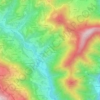
Name: Mortesina topographic map, elevation, terrain.
Location: Mortesina, Capizzone, Bergamo, Lombardia, 24030, Italia (45.76876 9.56142 45.80876 9.60142)
Average elevation: 1,913 ft
Minimum elevation: 889 ft
Maximum elevation: 3,346 ft
Thank you for supporting this site ❤️
Make a donation
Make a donation
Gear up for your next adventure:
As an Amazon Associate, this site earns from qualifying purchases at no extra cost to you.