
Thank you for supporting this site ❤️
Make a donation
Make a donation
Gear up for your next adventure:
As an Amazon Associate, this site earns from qualifying purchases at no extra cost to you.
Sierra topographic map
Click on the map to display elevation.
Thank you for supporting this site ❤️
Make a donation
Make a donation
Gear up for your next adventure:
As an Amazon Associate, this site earns from qualifying purchases at no extra cost to you.
About this map
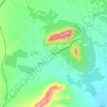
Name: Sierra topographic map, elevation, terrain.
Location: Sierra, Tobarra, Albacete, Castilla-La Mancha, 02513, España (38.54087 -1.67930 38.58087 -1.63930)
Average elevation: 1,929 ft
Minimum elevation: 1,716 ft
Maximum elevation: 2,441 ft
Thank you for supporting this site ❤️
Make a donation
Make a donation
Gear up for your next adventure:
As an Amazon Associate, this site earns from qualifying purchases at no extra cost to you.