
Thank you for supporting this site ❤️
Make a donation
Make a donation
Gear up for your next adventure:
As an Amazon Associate, this site earns from qualifying purchases at no extra cost to you.
Ures topographic map
Click on the map to display elevation.
Thank you for supporting this site ❤️
Make a donation
Make a donation
Gear up for your next adventure:
As an Amazon Associate, this site earns from qualifying purchases at no extra cost to you.
About this map
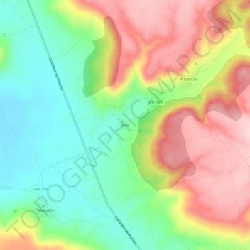
Name: Ures topographic map, elevation, terrain.
Location: Ures, Sigüenza, Guadalajara, Castilla-La Mancha, 19250, España (41.08442 -2.69382 41.12442 -2.65382)
Average elevation: 3,392 ft
Minimum elevation: 3,041 ft
Maximum elevation: 3,816 ft
Thank you for supporting this site ❤️
Make a donation
Make a donation
Gear up for your next adventure:
As an Amazon Associate, this site earns from qualifying purchases at no extra cost to you.