
Thank you for supporting this site ❤️
Make a donation
Make a donation
Gear up for your next adventure:
As an Amazon Associate, this site earns from qualifying purchases at no extra cost to you.
Kalbar topographic map
Click on the map to display elevation.
Thank you for supporting this site ❤️
Make a donation
Make a donation
Gear up for your next adventure:
As an Amazon Associate, this site earns from qualifying purchases at no extra cost to you.
About this map
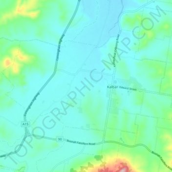
Name: Kalbar topographic map, elevation, terrain.
Location: Kalbar, Scenic Rim Regional, Queensland, 4309, Australia (-27.96478 152.56639 -27.91255 152.65581)
Average elevation: 348 ft
Minimum elevation: 210 ft
Maximum elevation: 1,047 ft
Thank you for supporting this site ❤️
Make a donation
Make a donation
Gear up for your next adventure:
As an Amazon Associate, this site earns from qualifying purchases at no extra cost to you.