
Thank you for supporting this site ❤️
Make a donation
Make a donation
Gear up for your next adventure:
As an Amazon Associate, this site earns from qualifying purchases at no extra cost to you.
Oliva topographic map
Click on the map to display elevation.
Thank you for supporting this site ❤️
Make a donation
Make a donation
Gear up for your next adventure:
As an Amazon Associate, this site earns from qualifying purchases at no extra cost to you.
About this map
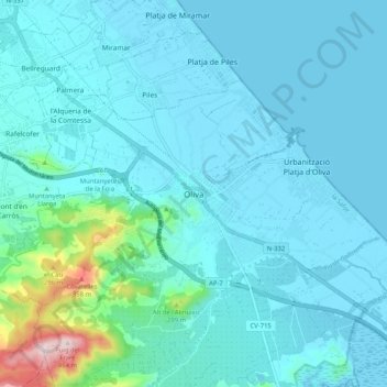
Name: Oliva topographic map, elevation, terrain.
Location: Oliva, la Safor, Valencia, Valencian Community, 46780, Spain (38.88024 -0.16090 38.96024 -0.08090)
Average elevation: 167 ft
Minimum elevation: -10 ft
Maximum elevation: 1,506 ft
Thank you for supporting this site ❤️
Make a donation
Make a donation
Gear up for your next adventure:
As an Amazon Associate, this site earns from qualifying purchases at no extra cost to you.