
Thank you for supporting this site ❤️
Make a donation
Make a donation
Gear up for your next adventure:
As an Amazon Associate, this site earns from qualifying purchases at no extra cost to you.
Stikal topographic map
Click on the map to display elevation.
Thank you for supporting this site ❤️
Make a donation
Make a donation
Gear up for your next adventure:
As an Amazon Associate, this site earns from qualifying purchases at no extra cost to you.
About this map
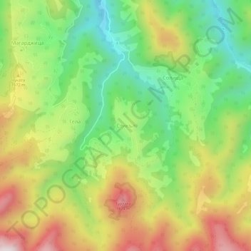
Name: Stikal topographic map, elevation, terrain.
Location: Stikal, Smolian, Smolyan, 4838, Bulgaria (41.62310 24.56369 41.66310 24.60369)
Average elevation: 4,823 ft
Minimum elevation: 3,763 ft
Maximum elevation: 6,194 ft
Thank you for supporting this site ❤️
Make a donation
Make a donation
Gear up for your next adventure:
As an Amazon Associate, this site earns from qualifying purchases at no extra cost to you.