
Thank you for supporting this site ❤️
Make a donation
Make a donation
Gear up for your next adventure:
As an Amazon Associate, this site earns from qualifying purchases at no extra cost to you.
Tamantit topographic map
Click on the map to display elevation.
Thank you for supporting this site ❤️
Make a donation
Make a donation
Gear up for your next adventure:
As an Amazon Associate, this site earns from qualifying purchases at no extra cost to you.
About this map
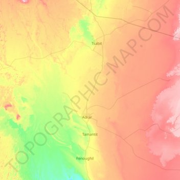
Name: Tamantit topographic map, elevation, terrain.
Location: Tamantit, Fenoughil District, Adrar, 1038, Algeria (27.61336 -0.34145 28.48116 0.97787)
Average elevation: 886 ft
Minimum elevation: 594 ft
Maximum elevation: 1,283 ft
Thank you for supporting this site ❤️
Make a donation
Make a donation
Gear up for your next adventure:
As an Amazon Associate, this site earns from qualifying purchases at no extra cost to you.