
Thank you for supporting this site ❤️
Make a donation
Make a donation
Gear up for your next adventure:
As an Amazon Associate, this site earns from qualifying purchases at no extra cost to you.
Feroke topographic map
Click on the map to display elevation.
Thank you for supporting this site ❤️
Make a donation
Make a donation
Gear up for your next adventure:
As an Amazon Associate, this site earns from qualifying purchases at no extra cost to you.
About this map
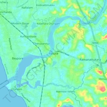
Name: Feroke topographic map, elevation, terrain.
Location: Feroke, Kozhikode, Kozhikode district, Kerala, 670576, India (11.15743 75.81374 11.19743 75.85374)
Average elevation: 39 ft
Minimum elevation: -7 ft
Maximum elevation: 121 ft
Thank you for supporting this site ❤️
Make a donation
Make a donation
Gear up for your next adventure:
As an Amazon Associate, this site earns from qualifying purchases at no extra cost to you.