
Thank you for supporting this site ❤️
Make a donation
Make a donation
Gear up for your next adventure:
As an Amazon Associate, this site earns from qualifying purchases at no extra cost to you.
Herderen topographic map
Click on the map to display elevation.
Thank you for supporting this site ❤️
Make a donation
Make a donation
Gear up for your next adventure:
As an Amazon Associate, this site earns from qualifying purchases at no extra cost to you.
About this map
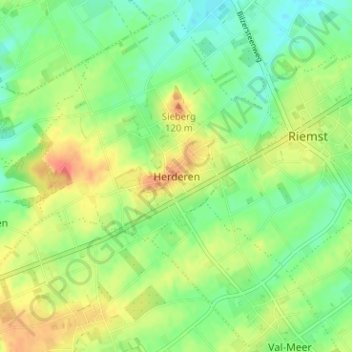
Name: Herderen topographic map, elevation, terrain.
Location: Herderen, Riemst, Tongres, Limbourg, Flandre, 3770, Belgique (50.78703 5.55423 50.82703 5.59423)
Average elevation: 338 ft
Minimum elevation: 269 ft
Maximum elevation: 427 ft
Thank you for supporting this site ❤️
Make a donation
Make a donation
Gear up for your next adventure:
As an Amazon Associate, this site earns from qualifying purchases at no extra cost to you.