
Thank you for supporting this site ❤️
Make a donation
Make a donation
Gear up for your next adventure:
As an Amazon Associate, this site earns from qualifying purchases at no extra cost to you.
Halma topographic map
Click on the map to display elevation.
Thank you for supporting this site ❤️
Make a donation
Make a donation
Gear up for your next adventure:
As an Amazon Associate, this site earns from qualifying purchases at no extra cost to you.
About this map
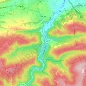
Name: Halma topographic map, elevation, terrain.
Location: Halma, Wellin, Neufchâteau, Luxemburg, Wallonië, 6922, België (50.02754 5.11509 50.08640 5.14769)
Average elevation: 974 ft
Minimum elevation: 594 ft
Maximum elevation: 1,378 ft
Thank you for supporting this site ❤️
Make a donation
Make a donation
Gear up for your next adventure:
As an Amazon Associate, this site earns from qualifying purchases at no extra cost to you.