Geolocate

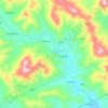
Bascaran topographic map

Click on the map to display elevation.

About this map

Name: Bascaran topographic map, elevation, terrain.

Location: Bascaran, Nueva Vizcaya, Cagayan Valley, 2709, Philippines (16.51612 121.20725 16.55612 121.24725)

Average elevation: 863 ft

Minimum elevation: 751 ft

Maximum elevation: 1,575 ft

Other topographic maps

Click on a map to view its topography, its elevation and its terrain.
Kasibu River

Philippines > Nueva Vizcaya > Kasibu

Average elevation: 2,841 ft

Casecnan River

Philippines > Nueva Vizcaya > Pelaway

Average elevation: 3,159 ft

Kayapa

Philippines > Nueva Vizcaya

Average elevation: 4,127 ft

Gear up for your next adventure:

📌Outdoor GPS Map App - Apps and devices for digital topographic navigation
💧Water Purification System - Clean water on the trail with reliable purifiers
📶Vehicle Signal Boosters - Improve reception in rural areas while driving to trailheads
📦Gear Storage Bags - Organize and protect outdoor equipment
📶Satellite Messenger - Communication device off‑grid

As an Amazon Associate, this site earns from qualifying purchases at no extra cost to you.