
Spring Gap topographic map
Click on the map to display elevation.
About this map
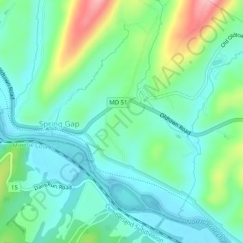
Name: Spring Gap topographic map, elevation, terrain.
Location: Spring Gap, Allegany County, Maryland, United States (39.55729 -78.71906 39.57384 -78.69521)
Average elevation: 689 ft
Minimum elevation: 541 ft
Maximum elevation: 1,089 ft
Allegany County trails, hiking, mountain biking, running and outdoor activities