
Thank you for supporting this site ❤️
Make a donation
Make a donation
Gear up for your next adventure:
As an Amazon Associate, this site earns from qualifying purchases at no extra cost to you.
Creel topographic map
Click on the map to display elevation.
Thank you for supporting this site ❤️
Make a donation
Make a donation
Gear up for your next adventure:
As an Amazon Associate, this site earns from qualifying purchases at no extra cost to you.
About this map
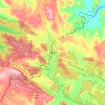
Name: Creel topographic map, elevation, terrain.
Location: Creel, Bocoyna, Chihuahua, 33200, Mexico (27.71302 -107.67435 27.79302 -107.59435)
Average elevation: 7,835 ft
Minimum elevation: 7,264 ft
Maximum elevation: 8,310 ft
Thank you for supporting this site ❤️
Make a donation
Make a donation
Gear up for your next adventure:
As an Amazon Associate, this site earns from qualifying purchases at no extra cost to you.