Geolocate

Ralli topographic map

Click on the map to display elevation.

About this map

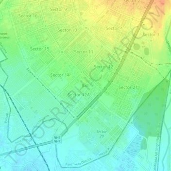
Name: Ralli topographic map, elevation, terrain.

Location: Ralli, Panchkula, Haryana, 134117, India (30.65680 76.83291 30.69680 76.87291)

Average elevation: 1,063 ft

Minimum elevation: 1,010 ft

Maximum elevation: 1,152 ft

Gear up for your next adventure:

📷Action Cameras - Rugged cameras to document your journeys across rugged terrain
🔋Rechargeable Batteries - Power up your outdoor devices
🛡️Insect Repellent - Protection against bugs during outdoor activities
😴Insulated Sleeping Pads - Compact and warm pads for high-elevation camping
📦Dry Bags Set - Waterproof storage for electronics and clothes

As an Amazon Associate, this site earns from qualifying purchases at no extra cost to you.