Geolocate

Parvin topographic map

Click on the map to display elevation.

About this map

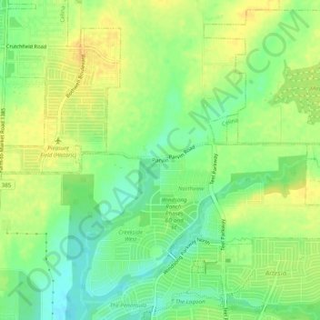
Name: Parvin topographic map, elevation, terrain.

Location: Parvin, Prosper, Denton County, Texas, United States (33.23345 -96.89028 33.27345 -96.85028)

Average elevation: 591 ft

Minimum elevation: 541 ft

Maximum elevation: 630 ft

Gear up for your next adventure:

🔪Outdoor Multitools - Essential survival tools for gear repair and field use
Backpacking Tent - Lightweight and durable tent for multi‑day hikes
🎒Day Hiking Backpack - Lightweight backpack perfect for day trips and outdoor adventures
📦Dry Bags Set - Waterproof storage for electronics and clothes
🔭Compact Binoculars - HD vision for scouting terrain and identifying distant landmarks

As an Amazon Associate, this site earns from qualifying purchases at no extra cost to you.