Geolocate

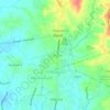
Pinagkuartelan topographic map

Click on the map to display elevation.

About this map

Name: Pinagkuartelan topographic map, elevation, terrain.

Location: Pinagkuartelan, Pandi, Bulacan, Central Luzon, Philippines (14.88739 120.97591 14.91036 120.98911)

Average elevation: 194 ft

Minimum elevation: 115 ft

Maximum elevation: 295 ft

Other topographic maps

Click on a map to view its topography, its elevation and its terrain.
Bunsuran Ⅲ

Philippines > Bulacan > Pandi

Average elevation: 43 ft

Santo Niño

Philippines > Bulacan > Pandi

Average elevation: 43 ft

San Roque

Philippines > Bulacan > Pandi

Average elevation: 85 ft

Bunsuran Ⅰ

Philippines > Bulacan > Pandi

Average elevation: 52 ft

Gear up for your next adventure:

🥾Hiking Shoes - Durable and comfortable shoes for trail hiking
📶Satellite Messenger - Communication device off‑grid
📖Nature Tracking Books - Learn to track wildlife and terrain
🌧️Backpack Rain Cover - Keep gear dry in wet weather
🔭Telescopic Hiking Pole - Adjustable pole for hiking stability

As an Amazon Associate, this site earns from qualifying purchases at no extra cost to you.