Geolocate

Punta Merciantaira / Grand Glaiza topographic map

Interactive map

Click on the map to display elevation.

About this map

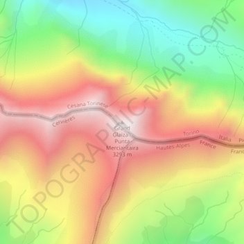
Name: Punta Merciantaira / Grand Glaiza topographic map, elevation, terrain.

Location: Punta Merciantaira / Grand Glaiza, Césane, Turin, Piémont, Italie (44.84955 6.88154 44.84965 6.88164)

Average elevation: 9,081 ft

Minimum elevation: 7,379 ft

Maximum elevation: 10,732 ft

Other topographic maps

Click on a map to view its topography, its elevation and its terrain.

Val Thuras

Italie > Piémont > Césane

Val Thuras, Ponte de l'Asia, Thuras, Césane, Turin, Piémont, Italie

Average elevation: 7,579 ft

Mollieres

Italie > Piémont > Césane > Mollieres

Mollieres, Césane, Turin, Piémont, Italie

Average elevation: 5,203 ft