Geolocate

St Ives topographic map

Click on the map to display elevation.

About this map

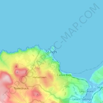
Name: St Ives topographic map, elevation, terrain.

Location: St Ives, South West England, England, TR26, United Kingdom (50.17489 -5.51956 50.25489 -5.43956)

Average elevation: 141 ft

Minimum elevation: -3 ft

Maximum elevation: 797 ft

Gear up for your next adventure:

🪶Fire Starter Kit - Reliable fire starter for survival and camping
🗺️NatGeo Topo Maps - High-quality waterproof printed topographic maps of US Parks
🦺Reflective Outdoor Gear - Safety gear for low‑light conditions
🦶Carbon Trekking Poles - Reduce knee impact on steep descents with ultra-light poles
🪵Folding Camp Saw - Compact saw for wood and campsite work

As an Amazon Associate, this site earns from qualifying purchases at no extra cost to you.