
Thank you for supporting this site ❤️
Make a donation
Make a donation
Gear up for your next adventure:
As an Amazon Associate, this site earns from qualifying purchases at no extra cost to you.
Sorá topographic map
Click on the map to display elevation.
Thank you for supporting this site ❤️
Make a donation
Make a donation
Gear up for your next adventure:
As an Amazon Associate, this site earns from qualifying purchases at no extra cost to you.
About this map
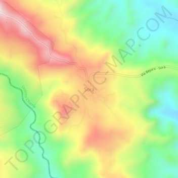
Name: Sorá topographic map, elevation, terrain.
Location: Sorá, Distrito de Chame, Panamá Oeste, Panama (8.61528 -80.02988 8.65528 -79.98988)
Average elevation: 1,348 ft
Minimum elevation: 489 ft
Maximum elevation: 2,388 ft
Thank you for supporting this site ❤️
Make a donation
Make a donation
Gear up for your next adventure:
As an Amazon Associate, this site earns from qualifying purchases at no extra cost to you.