
Thank you for supporting this site ❤️
Make a donation
Make a donation
Gear up for your next adventure:
As an Amazon Associate, this site earns from qualifying purchases at no extra cost to you.
Zempoala topographic map
Click on the map to display elevation.
Thank you for supporting this site ❤️
Make a donation
Make a donation
Gear up for your next adventure:
As an Amazon Associate, this site earns from qualifying purchases at no extra cost to you.
About this map
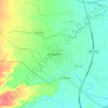
Name: Zempoala topographic map, elevation, terrain.
Location: Zempoala, Úrsulo Galván, Veracruz, 91660, México (19.40444 -96.44830 19.48444 -96.36830)
Average elevation: 89 ft
Minimum elevation: 20 ft
Maximum elevation: 243 ft
Thank you for supporting this site ❤️
Make a donation
Make a donation
Gear up for your next adventure:
As an Amazon Associate, this site earns from qualifying purchases at no extra cost to you.
Other topographic maps
Click on a map to view its topography, its elevation and its terrain.
Playa de Chachalacas
México > Veracruz > Ursulo Galván > Playa de Chachalacas > Los Médanos
Average elevation: 30 ft