Geolocate

Matagorda Bay topographic map

Click on the map to display elevation.

About this map

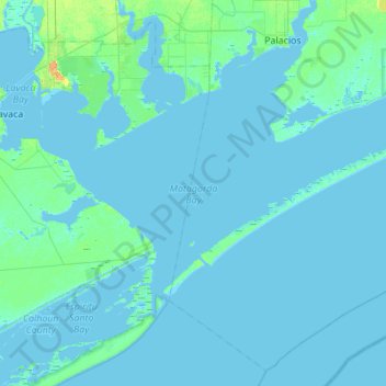
Name: Matagorda Bay topographic map, elevation, terrain.

Location: Matagorda Bay, Matagorda County, Texas, United States (28.35634 -96.52353 28.67286 -95.97169)

Average elevation: 7 ft

Minimum elevation: -7 ft

Maximum elevation: 82 ft

Matagorda County trails, hiking, mountain biking, running and outdoor activities

Other topographic maps

Click on a map to view its topography, its elevation and its terrain.

Markham

United States > Texas > Matagorda County

Average elevation: 56 ft

Blessing

United States > Texas > Matagorda County

Average elevation: 43 ft

Wadsworth

United States > Texas > Matagorda County > Wadsworth

Average elevation: 33 ft

Palacios

United States > Texas > Matagorda County > Palacios > Palacios

Average elevation: 10 ft

Cedar Lane

United States > Texas > Matagorda County > Cedar Lane

Average elevation: 30 ft

Gear up for your next adventure:

🔪Outdoor Multitools - Essential survival tools for gear repair and field use
🔌USB Car Charger - Car charger for on‑the‑go power needs
🗺️NatGeo Topo Maps - High-quality waterproof printed topographic maps of US Parks
❄️Traction Cleats - Prevent slips on icy trails during winter hikes
🎒Day Hiking Backpack - Lightweight backpack perfect for day trips and outdoor adventures

As an Amazon Associate, this site earns from qualifying purchases at no extra cost to you.