Geolocate

River Loddon topographic map

Click on the map to display elevation.

About this map

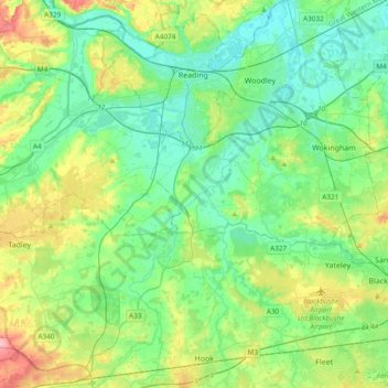
Name: River Loddon topographic map, elevation, terrain.

Location: River Loddon, Winnersh, Berkshire, England, United Kingdom (51.26495 -1.06455 51.50188 -0.86496)

Average elevation: 223 ft

Minimum elevation: 102 ft

Maximum elevation: 554 ft

Gear up for your next adventure:

🛏️Cold Weather Sleeping Bag - Warm sleeping bag for cold conditions
🧥Waterproof Jacket for Hiking - Breathable and rugged rain jacket for outdoor excursions
🏕️Family Camping Gear - Essentials for group camping trips
Backpacking Tents - Weight-optimized shelters for multi-day topographic surveys
🛌Ultralight Sleeping Bags - Compact down bags for cold nights in the wilderness

As an Amazon Associate, this site earns from qualifying purchases at no extra cost to you.