Geolocate

Tafelberg topographic map

Click on the map to display elevation.

About this map

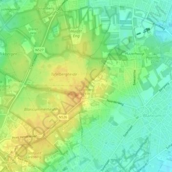
Name: Tafelberg topographic map, elevation, terrain.

Location: Tafelberg, Lage Laarderweg, Tafelberger Heide, Huizen, North Holland, Netherlands, 1261 BM, Netherlands (52.27708 5.22719 52.27718 5.22729)

Average elevation: 49 ft

Minimum elevation: 0 ft

Maximum elevation: 102 ft

Other topographic maps

Click on a map to view its topography, its elevation and its terrain.

Huizen

Netherlands > North Holland > Huizen

Topographic map of Huizen, March 2014.

Average elevation: 10 ft

Gear up for your next adventure:

🌡️Portable Weather Meter - Track weather conditions on the trail
🌧️Backpack Rain Cover - Keep gear dry in wet weather
🥩Freeze-Dried Meals - Nutritious and lightweight food for remote expeditions
🦟Ultrasonic Repellers - Create a bug-free zone at your camp or rest stop
🥇GPS Hiking Watch - Multi‑sport GPS watch with navigation and trail tracking

As an Amazon Associate, this site earns from qualifying purchases at no extra cost to you.