Geolocate

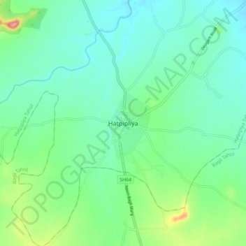
Hatpipalya topographic map

Click on the map to display elevation.

Hatpipalya

Hatpipliya lies on the Malwa Plateau. Due of its high elevation and inland location, even during the hottest months of the year, the nights are relatively cool, which is known as Shab-e-Malwa. Three distinct seasons are observed: summer, monsoon and winter. Hatpipliya gets moderate rainfall of 960 millimetres (38 in), mostly during July–September due to the southwest monsoon.

Wikipedia (CC-BY-SA 3.0)

About this map

Name: Hatpipalya topographic map, elevation, terrain.

Location: Hatpipalya, Hatpiplya Tahsil, Dewas, Madhya Pradesh, 455223, India (22.73201 76.26144 22.81201 76.34144)

Average elevation: 1,716 ft

Minimum elevation: 1,631 ft

Maximum elevation: 1,975 ft

Gear up for your next adventure:

👓Polarized Sunglasses - Outdoor sunglasses for glare reduction
🌎3D Topographic Globes - Raised relief globes for a tactile understanding of geography
🪶LED Camping Lantern - Bright lantern for camp lighting
🎒Gear Packing Cubes - Organize your backpack efficiently
🪶Compact Camp Shovel - Folding shovel for campsite tasks

As an Amazon Associate, this site earns from qualifying purchases at no extra cost to you.