
Santa Maria topographic map
Click on the map to display elevation.
About this map
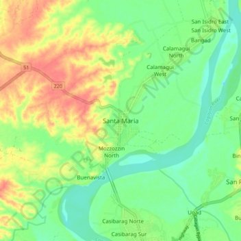
Name: Santa Maria topographic map, elevation, terrain.
Location: Santa Maria, Isabela, Cagayan Valley, 3329, Philippines (17.42877 121.71251 17.50877 121.79251)
Average elevation: 108 ft
Minimum elevation: 30 ft
Maximum elevation: 217 ft
Other topographic maps
Click on a map to view its topography, its elevation and its terrain.