
Thank you for supporting this site ❤️
Make a donation
Make a donation
Gear up for your next adventure:
As an Amazon Associate, this site earns from qualifying purchases at no extra cost to you.
Palin topographic map
Click on the map to display elevation.
Thank you for supporting this site ❤️
Make a donation
Make a donation
Gear up for your next adventure:
As an Amazon Associate, this site earns from qualifying purchases at no extra cost to you.
About this map
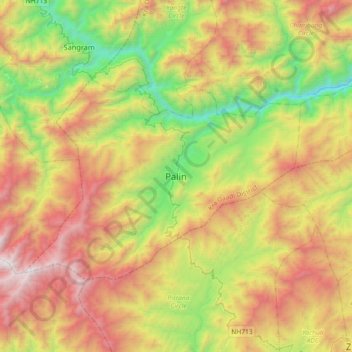
Name: Palin topographic map, elevation, terrain.
Location: Palin, Palin Circle, Kra Daadi, Arunachal Pradesh, India (27.53369 93.47188 27.85369 93.79188)
Average elevation: 5,085 ft
Minimum elevation: 1,588 ft
Maximum elevation: 9,616 ft
Thank you for supporting this site ❤️
Make a donation
Make a donation
Gear up for your next adventure:
As an Amazon Associate, this site earns from qualifying purchases at no extra cost to you.