Geolocate

Millville topographic map

Click on the map to display elevation.

About this map

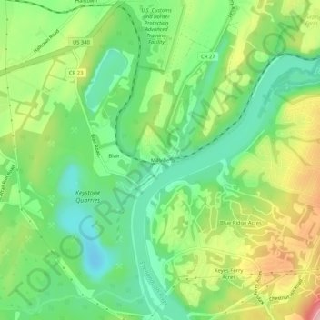
Name: Millville topographic map, elevation, terrain.

Location: Millville, Jefferson County, West Virginia, 25425, United States (39.27399 -77.80583 39.31399 -77.76583)

Average elevation: 417 ft

Minimum elevation: 184 ft

Maximum elevation: 791 ft

Jefferson County trails, hiking, mountain biking, running and outdoor activities

Other topographic maps

Click on a map to view its topography, its elevation and its terrain.

Ranson

United States > West Virginia > Jefferson County

Average elevation: 528 ft

Gear up for your next adventure:

GPS Sports Watch - GPS watch for running, hiking and training
📶Vehicle Signal Boosters - Improve reception in rural areas while driving to trailheads
🛰️Handheld GPS Units - Professional satellite navigators for precise backcountry mapping
🪄Magnetic Compass - Accurate compass for navigation
🥤Water Filter Bottle - All‑in‑one filter bottle for safe hydration

As an Amazon Associate, this site earns from qualifying purchases at no extra cost to you.