Geolocate

Udong topographic map

Click on the map to display elevation.

About this map

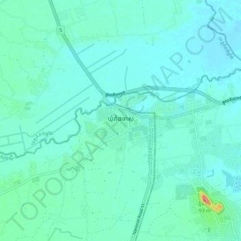
Name: Udong topographic map, elevation, terrain.

Location: Udong, Odongk, Kampong Speu, Cambodia (11.78109 104.70004 11.86109 104.78004)

Average elevation: 56 ft

Minimum elevation: 13 ft

Maximum elevation: 305 ft

Gear up for your next adventure:

🧭Compass with Lanyard - Easy‑carry compass for navigation
🔌Solar Panel Charger - Charge gear sustainably outdoors
🗺️Topographic Maps - Detailed topo maps for hiking, exploring and outdoor navigation
🕶️Glacier Sunglasses - Side shields to protect eyes from high-altitude snow glare
🪑Portable Camp Table - Compact table for campsite meals

As an Amazon Associate, this site earns from qualifying purchases at no extra cost to you.