Geolocate

Manson topographic map

Click on the map to display elevation.

About this map

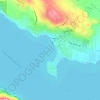
Name: Manson topographic map, elevation, terrain.

Location: Manson, Chelan County, Washington, United States (47.86652 -120.18717 47.89611 -120.13986)

Average elevation: 1,158 ft

Minimum elevation: 1,086 ft

Maximum elevation: 1,467 ft

Chelan County trails, hiking, mountain biking, running and outdoor activities

Gear up for your next adventure:

🧯Emergency Survival Kit - All‑in‑one survival essentials for the backcountry
🎒Trail Energy Bars - High‑calorie bars for hiking energy
🧦Hiking Socks - Comfortable socks to prevent blisters on long hikes
🪶Fire Starter Kit - Reliable fire starter for survival and camping
🌧️Backpack Rain Cover - Keep gear dry in wet weather

As an Amazon Associate, this site earns from qualifying purchases at no extra cost to you.