
Thank you for supporting this site ❤️
Make a donation
Make a donation
Gear up for your next adventure:
As an Amazon Associate, this site earns from qualifying purchases at no extra cost to you.
Pizzuta topographic map
Click on the map to display elevation.
Thank you for supporting this site ❤️
Make a donation
Make a donation
Gear up for your next adventure:
As an Amazon Associate, this site earns from qualifying purchases at no extra cost to you.
About this map
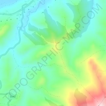
Name: Pizzuta topographic map, elevation, terrain.
Location: Pizzuta, Sant'Arcangelo, Potenza, Basilicata, Italia (40.24009 16.29741 40.26009 16.31741)
Average elevation: 938 ft
Minimum elevation: 673 ft
Maximum elevation: 1,585 ft
Thank you for supporting this site ❤️
Make a donation
Make a donation
Gear up for your next adventure:
As an Amazon Associate, this site earns from qualifying purchases at no extra cost to you.