
Thank you for supporting this site ❤️
Make a donation
Make a donation
Gear up for your next adventure:
As an Amazon Associate, this site earns from qualifying purchases at no extra cost to you.
Mahuaypampa topographic map
Click on the map to display elevation.
Thank you for supporting this site ❤️
Make a donation
Make a donation
Gear up for your next adventure:
As an Amazon Associate, this site earns from qualifying purchases at no extra cost to you.
About this map
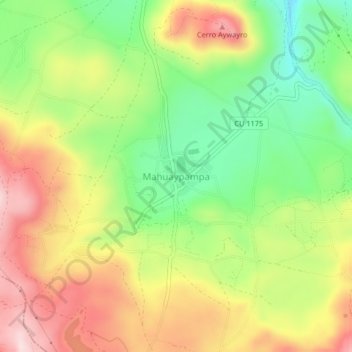
Name: Mahuaypampa topographic map, elevation, terrain.
Location: Mahuaypampa, Maras, Urubamba, Cusco, Perú (-13.39028 -72.17931 -13.35028 -72.13931)
Average elevation: 11,706 ft
Minimum elevation: 11,191 ft
Maximum elevation: 12,270 ft
Thank you for supporting this site ❤️
Make a donation
Make a donation
Gear up for your next adventure:
As an Amazon Associate, this site earns from qualifying purchases at no extra cost to you.