Geolocate

Melalap topographic map

Click on the map to display elevation.

About this map

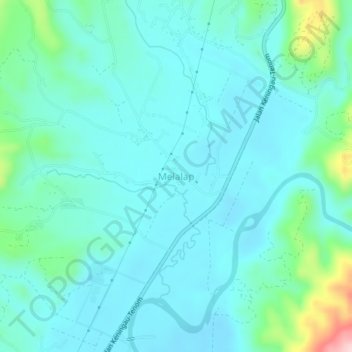
Name: Melalap topographic map, elevation, terrain.

Location: Melalap, Tenom, Interior Division, Sabah, Malaysia (5.22360 115.97564 5.26360 116.01564)

Average elevation: 735 ft

Minimum elevation: 597 ft

Maximum elevation: 1,411 ft

Gear up for your next adventure:

⛑️Personal Locator Beacon - Safety beacon for emergencies
🧤Hiking Gloves - Protective gloves for rugged trails
🎒Outdoor Daypacks - Lightweight backpacks designed for carrying maps and essential gear
🎒Waterproof Dry Bags - Keep your electronics and maps dry inside your pack
Solar GPS Watches - Advanced multisport watches with built-in topographic maps

As an Amazon Associate, this site earns from qualifying purchases at no extra cost to you.