Geolocate

Rice topographic map

Click on the map to display elevation.

About this map

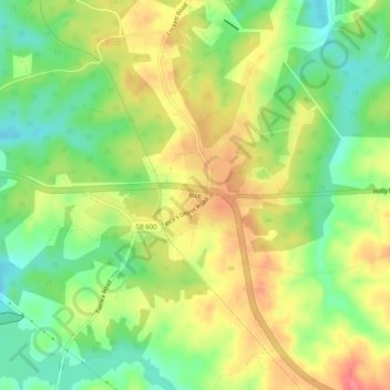
Name: Rice topographic map, elevation, terrain.

Location: Rice, Prince Edward County, Virginia, United States (37.25321 -78.31039 37.29321 -78.27039)

Average elevation: 420 ft

Minimum elevation: 305 ft

Maximum elevation: 541 ft

Prince Edward County trails, hiking, mountain biking, running and outdoor activities

Other topographic maps

Click on a map to view its topography, its elevation and its terrain.

Farmville

United States > Virginia > Prince Edward County

Average elevation: 371 ft

Gear up for your next adventure:

🪶Thermal Camp Blanket - Extra warmth for cold nights
🛶Inflatable Kayak - Portable kayak for rivers, lakes, and expeditions
🪶Wildlife Field Guides - Learn animal tracking and species ID
🔪Outdoor Multitools - Essential survival tools for gear repair and field use
🧤Hiking Gloves - Protective gloves for rugged trails

As an Amazon Associate, this site earns from qualifying purchases at no extra cost to you.