
Thank you for supporting this site ❤️
Make a donation
Make a donation
Gear up for your next adventure:
As an Amazon Associate, this site earns from qualifying purchases at no extra cost to you.
Guayabitos topographic map
Click on the map to display elevation.
Thank you for supporting this site ❤️
Make a donation
Make a donation
Gear up for your next adventure:
As an Amazon Associate, this site earns from qualifying purchases at no extra cost to you.
About this map
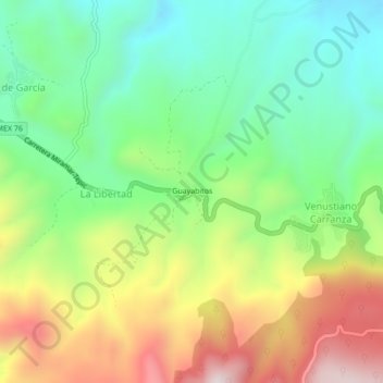
Name: Guayabitos topographic map, elevation, terrain.
Location: Guayabitos, La Libertad, Tepic, Nayarit, 63711, Mexico (21.50086 -105.02128 21.54086 -104.98128)
Average elevation: 3,694 ft
Minimum elevation: 2,736 ft
Maximum elevation: 5,194 ft
Thank you for supporting this site ❤️
Make a donation
Make a donation
Gear up for your next adventure:
As an Amazon Associate, this site earns from qualifying purchases at no extra cost to you.