
Matroosberg topographic map
Click on the map to display elevation.
About this map
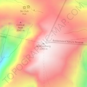
Name: Matroosberg topographic map, elevation, terrain.
Average elevation: 6,191 ft
Minimum elevation: 3,737 ft
Maximum elevation: 7,339 ft
Other topographic maps
Click on a map to view its topography, its elevation and its terrain.
Witzenberg Ward 9
South Africa > Western Cape > Cape Winelands District Municipality > Witzenberg Local Municipality
Average elevation: 2,927 ft
Tankwa Town
South Africa > Western Cape > Cape Winelands District Municipality > Witzenberg Local Municipality
Average elevation: 1,565 ft
Tankwa Town
South Africa > Western Cape > Cape Winelands District Municipality > Witzenberg Local Municipality
Average elevation: 1,565 ft