
Zemst topographic map
Click on the map to display elevation.
About this map
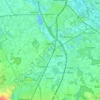
Name: Zemst topographic map, elevation, terrain.
Location: Zemst, Halle-Vilvoorde, Flemish Brabant, Flanders, Belgium (50.94653 4.36940 51.00931 4.52870)
Average elevation: 33 ft
Minimum elevation: -3 ft
Maximum elevation: 161 ft
Other topographic maps
Click on a map to view its topography, its elevation and its terrain.
La Fresnaye
Belgium > Flemish Brabant > Halle-Vilvoorde > Buizingen > Ziekendries
Average elevation: 236 ft
Lac de Genval - Meer van Genval
Belgium > Flemish Brabant > Halle-Vilvoorde > Overijse > Genval
Average elevation: 262 ft