
Reuth topographic map
Click on the map to display elevation.
Reuth
Das Pfarrdorf in der naturräumlichen Landschaftseinheit des Regnitztals liegt etwa vier Kilometer östlich des Ortszentrums von Forchheim auf einer Höhe von 332 m ü. NHN und ist mit dem Siedlungsgebiet von Forchheim zusammengewachsen.
About this map
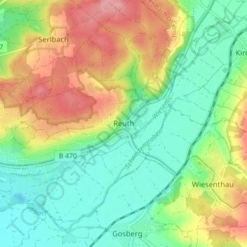
Name: Reuth topographic map, elevation, terrain.
Average elevation: 997 ft
Minimum elevation: 853 ft
Maximum elevation: 1,214 ft