Geolocate

Lake Robinson topographic map

Click on the map to display elevation.

About this map

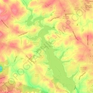
Name: Lake Robinson topographic map, elevation, terrain.

Location: Lake Robinson, Greer, Greenville County, South Carolina, United States (34.99225 -82.32942 35.04145 -82.29293)

Average elevation: 958 ft

Minimum elevation: 719 ft

Maximum elevation: 1,102 ft

Other topographic maps

Click on a map to view its topography, its elevation and its terrain.

Maple

United States > South Carolina > Greenville County > Greer

Average elevation: 965 ft

Gear up for your next adventure:

🛰️Satellite Messengers - Emergency SOS and two-way messaging for off-grid adventures
📖Nature Tracking Books - Learn to track wildlife and terrain
🧭Compass with Lanyard - Easy‑carry compass for navigation
🛏️Cold Weather Sleeping Bag - Warm sleeping bag for cold conditions
🌄Hiking Binoculars - Compact binoculars for scenic views and trail spotting

As an Amazon Associate, this site earns from qualifying purchases at no extra cost to you.