
Thank you for supporting this site ❤️
Make a donation
Make a donation
Gear up for your next adventure:
As an Amazon Associate, this site earns from qualifying purchases at no extra cost to you.
Kirengeli topographic map
Click on the map to display elevation.
Thank you for supporting this site ❤️
Make a donation
Make a donation
Gear up for your next adventure:
As an Amazon Associate, this site earns from qualifying purchases at no extra cost to you.
About this map
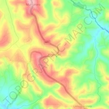
Name: Kirengeli topographic map, elevation, terrain.
Location: Kirengeli, Byimana, Southern Province, Rwanda (-2.17154 29.73334 -2.13154 29.77334)
Average elevation: 5,876 ft
Minimum elevation: 5,623 ft
Maximum elevation: 6,119 ft
Thank you for supporting this site ❤️
Make a donation
Make a donation
Gear up for your next adventure:
As an Amazon Associate, this site earns from qualifying purchases at no extra cost to you.