
LaSalle topographic map
Click on the map to display elevation.
About this map
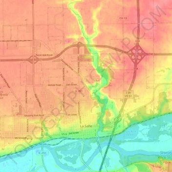
Name: LaSalle topographic map, elevation, terrain.
Location: LaSalle, LaSalle County, Illinois, 61301, United States (41.31460 -89.12062 41.39035 -89.01014)
Average elevation: 591 ft
Minimum elevation: 433 ft
Maximum elevation: 692 ft
LaSalle County trails, hiking, mountain biking, running and outdoor activities
Other topographic maps
Click on a map to view its topography, its elevation and its terrain.
Lower Fox River - Blakes Landing Nature Preserve
United States > Illinois > LaSalle County > Blakes
Average elevation: 597 ft