
Thank you for supporting this site ❤️
Make a donation
Make a donation
Gear up for your next adventure:
As an Amazon Associate, this site earns from qualifying purchases at no extra cost to you.
Sentfores topographic map
Click on the map to display elevation.
Thank you for supporting this site ❤️
Make a donation
Make a donation
Gear up for your next adventure:
As an Amazon Associate, this site earns from qualifying purchases at no extra cost to you.
About this map
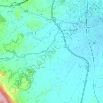
Name: Sentfores topographic map, elevation, terrain.
Location: Sentfores, Vic, Osona, Barcelona, Cataluña, 08500, España (41.89494 2.21005 41.93494 2.25005)
Average elevation: 1,722 ft
Minimum elevation: 1,578 ft
Maximum elevation: 2,556 ft
Thank you for supporting this site ❤️
Make a donation
Make a donation
Gear up for your next adventure:
As an Amazon Associate, this site earns from qualifying purchases at no extra cost to you.