Geolocate

Daniawan topographic map

Click on the map to display elevation.

About this map

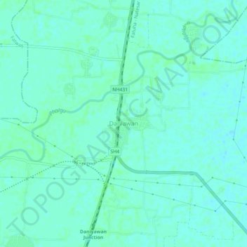
Name: Daniawan topographic map, elevation, terrain.

Location: Daniawan, Patna District, Bihar, 803201, India (25.41729 85.27225 25.45729 85.31225)

Average elevation: 161 ft

Minimum elevation: 151 ft

Maximum elevation: 167 ft

Gear up for your next adventure:

👟Men's Trail Runners - Lightweight footwear for fast-paced exploration and light hiking
🧭Map Reading Tools - Tools and kits for map navigation
🧭Hiking Compass - Precision compass for reliable navigation in the wilderness
Camping Coffee Makers - Enjoy premium coffee at the summit or campsite
🧯Emergency Survival Kit - All‑in‑one survival essentials for the backcountry

As an Amazon Associate, this site earns from qualifying purchases at no extra cost to you.