
Thank you for supporting this site ❤️
Make a donation
Make a donation
Gear up for your next adventure:
As an Amazon Associate, this site earns from qualifying purchases at no extra cost to you.
Bhumiyadhar topographic map
Click on the map to display elevation.
Thank you for supporting this site ❤️
Make a donation
Make a donation
Gear up for your next adventure:
As an Amazon Associate, this site earns from qualifying purchases at no extra cost to you.
About this map
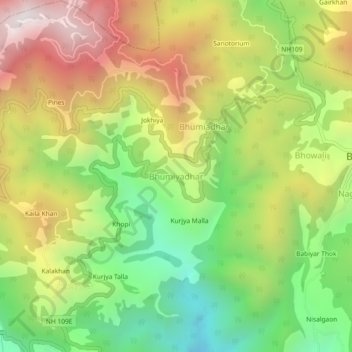
Name: Bhumiyadhar topographic map, elevation, terrain.
Location: Bhumiyadhar, Nainital, Uttarakhand, 263003, India (29.36002 79.47617 29.40002 79.51617)
Average elevation: 5,604 ft
Minimum elevation: 3,543 ft
Maximum elevation: 8,035 ft
Thank you for supporting this site ❤️
Make a donation
Make a donation
Gear up for your next adventure:
As an Amazon Associate, this site earns from qualifying purchases at no extra cost to you.