Geolocate

Brig topographic map

Click on the map to display elevation.

About this map

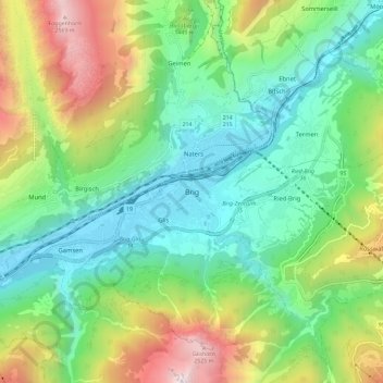
Name: Brig topographic map, elevation, terrain.

Location: Brig, Brig-Glis, Brig, Wallis, 3900, Switzerland (46.27635 7.94795 46.35635 8.02795)

Average elevation: 4,245 ft

Minimum elevation: 2,142 ft

Maximum elevation: 8,743 ft

Gear up for your next adventure:

🧦Hiking Socks - Comfortable socks to prevent blisters on long hikes
📷Action Camera - Capture your outdoor adventures in HD
🔌USB Car Charger - Car charger for on‑the‑go power needs
🕶️Glacier Sunglasses - Side shields to protect eyes from high-altitude snow glare
🪶Camping Sleeping Pad - Comfortable sleeping pad for backpacking

As an Amazon Associate, this site earns from qualifying purchases at no extra cost to you.