
Thank you for supporting this site ❤️
Make a donation
Make a donation
Gear up for your next adventure:
As an Amazon Associate, this site earns from qualifying purchases at no extra cost to you.
Carpesino topographic map
Click on the map to display elevation.
Thank you for supporting this site ❤️
Make a donation
Make a donation
Gear up for your next adventure:
As an Amazon Associate, this site earns from qualifying purchases at no extra cost to you.
About this map
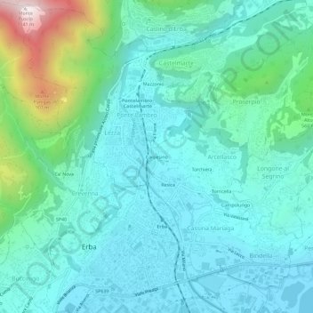
Name: Carpesino topographic map, elevation, terrain.
Location: Carpesino, Arcellasco, Erba, Como, Lombardia, 22030, Italia (45.80120 9.20908 45.84120 9.24908)
Average elevation: 1,394 ft
Minimum elevation: 846 ft
Maximum elevation: 3,707 ft
Thank you for supporting this site ❤️
Make a donation
Make a donation
Gear up for your next adventure:
As an Amazon Associate, this site earns from qualifying purchases at no extra cost to you.